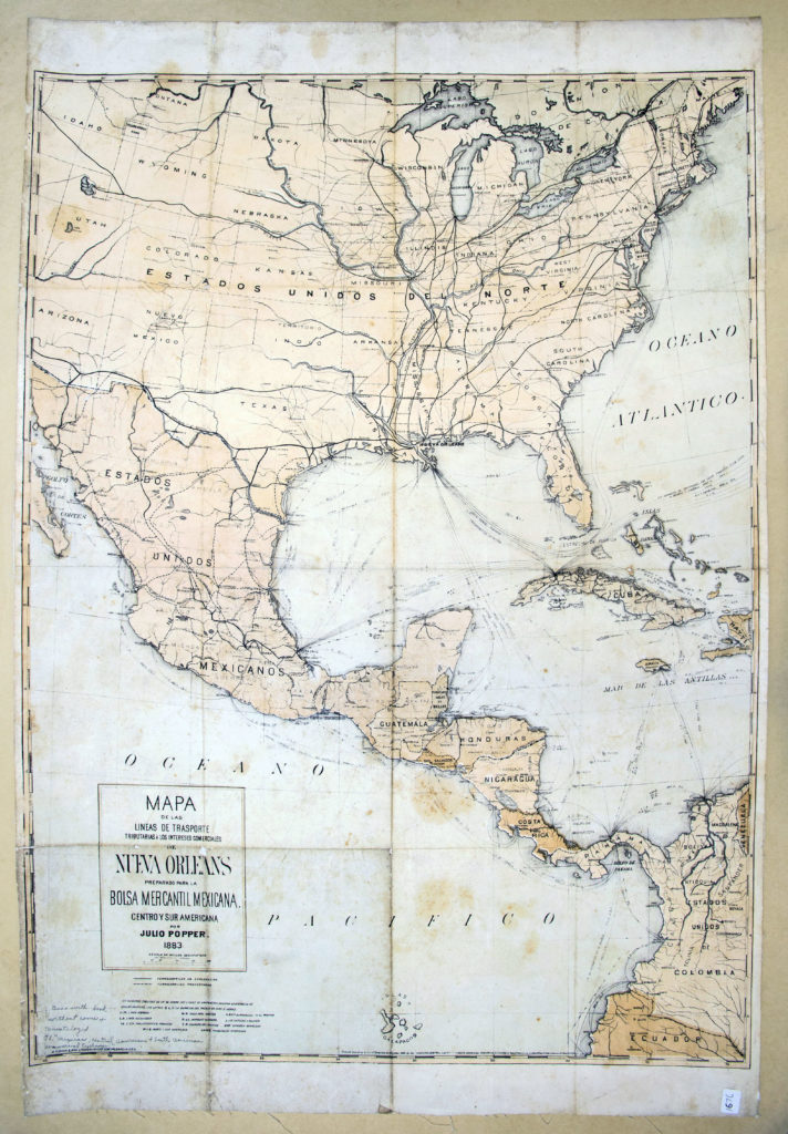
According to an 1884 report to the United States Commission on Mexican, Central American, and South American trade: “No city in the United States has a deeper interest in the subject of trade with Mexico, Central and South America than New Orleans.” Among the many advantages possessed by New Orleans cited in the report is its intermediate position between the Gulf of Mexico and the Mississippi River Valley making it a natural focal point to handle incoming and outgoing freight between North and South. To illustrate this point, below is a stunningly bold 1883 map by Julius Popper.

Mapa de las Lineas de Trasporte Tributarias a los Intereses Comerciales de Nueva Orleans (1883), edited by Julius Popper. Map Collection, The Latin American Library
This large color-lithograph map illustrates the centrality of New Orleans to Pan-American, Pan-Gulf commerce at the end of the 19th century. It records an impressive array of known and projected lines of rail and sea transportation routes connecting New Orleans to port cities across the Caribbean and Circum-Gulf Coast as well as to United States cities along the eastern seaboard and via the Mississippi Valley. The proposed Panama Canal is also illustrated though its construction by the French had only begun the year before this map’s publication.
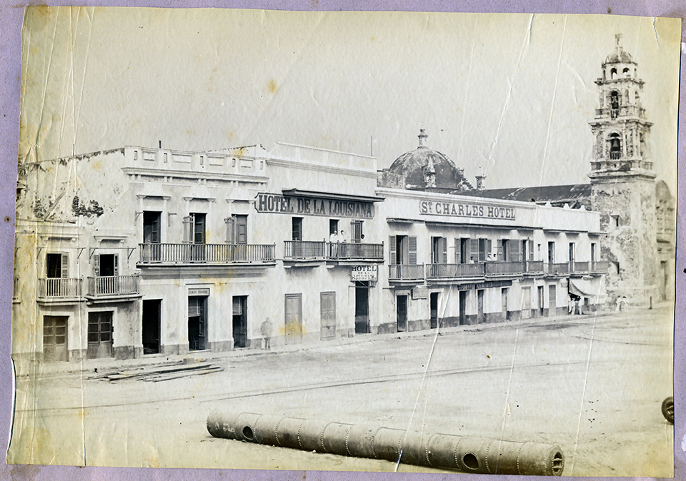
Another example of the role of New Orleans in the Circum-Gulf is provided by the image shown below. On exhibit, an image of an 1887 albumen print collected by the Mexican sculptor, Ernesto Scheleske y Aguirre, in a personal photograph album. The image shows a street in downtown Veracruz, a key Gulf port city in Mexico, with the facades of the Hotel de la Louisiana and St. Charles Hotel as the central subject of the photograph that belies a close connection with the city of New Orleans.

Street in downtown Veracruz, Mexico, albumen print, 1887. Image Archive, The Latin American Library.
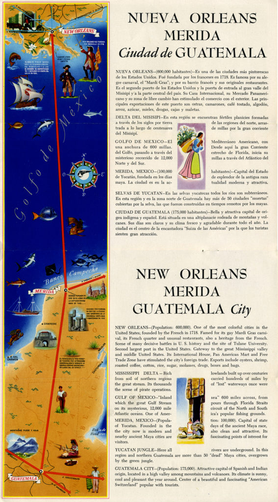
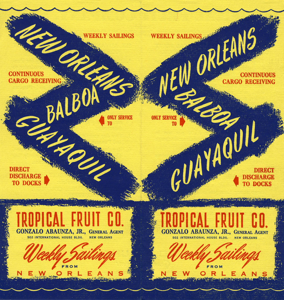
Routes of transportation vital for commercial purposes (railroads and steamship lines) would also become crucial to a growing tourism industry aimed at North Americans that took hold in the late 19th century and grew throughout the 20th century. Tourism was spurred by the introduction of the motor car, paved roads and highway systems, air travel, increased leisure time, and disposable incomes. Two pieces of print ephemera from the Library’s collections show the use of colorful advertising and bilingual text used to promote shipping and travel between New Orleans and Latin America.
Below, a promotional brochure produced by the Latin American Division of Pan American World Airways, Inc., circa 1940s -1950s, advertising air travel from New Orleans to Mérida (Yucatán, Mexico) and Guatemala City. The advertisers highlight the founding of New Orleans by the French, its pirate history, carnival tradition, its exports, and Tulane University! Described is the Mississippi Delta, the Gulf of Mexico, Mérida, the Yucatán Peninsula, and Guatemala City. The latter is billed as the “American Switzerland popular with tourists!” Below, another colorful brochure circa 1960s from the Tropical Fruit Co. highlighting the advantages of shipping out of New Orleans to Balboa, Panama and Guayaquil, Ecuador via the Panama Canal. The many fruit companies headquartered in New Orleans since the beginning of the 20th century were instrumental in cementing trade relations, the flow of immigration, and cultural exchange between the city and neighbors to the south.

Trifold color brochure for Pan American Airlines, c. 1940s-1950s. Latin American Travel and Tourism Ephemera Collection, The Latin American Library.

Duofold color brochure for the Tropical Fruit Co., circa 1960s. Latin America Print Ephemera Collection, The Latin American Library